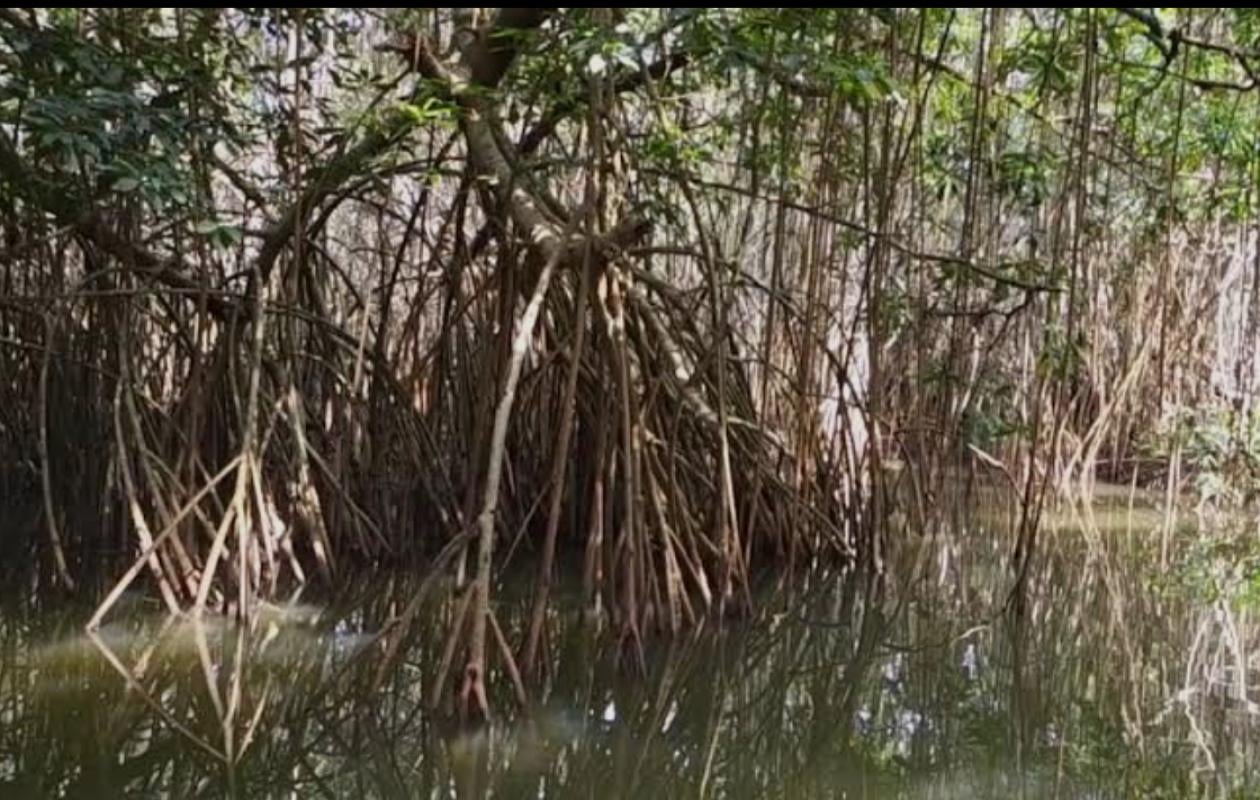
Les mangroves de l'Afrique de l'Ouest menacées par la déforestation, la pollution et les changements climatiques : Les experts en quête de solutions
West African mangroves, key ecosystems for biodiversity and food security for local populations, are threatened by deforestation, pollution, and climate change. This was the conclusion reached at the opening of the TAMAO 2025 symposium, themed "Remote Sensing Applied to Mapping the State and Dynamics of West African Mangroves: Towards the End of Controversies?", organized by the Polytechnic School of Thiès (EPT), from December 18 to 20, 2025.
"Our project aims to use remote sensing to study the dynamics of these ecosystems and identify priority areas for conservation," says the organizing committee of this important meeting dedicated to the preservation of mangroves, unique ecosystems, made up, among others, of professors Julien Andrieu (University of Nice Côte d'Azur), Ababacar Fall (Polytechnic School of Thiès), El Hadj Balla Dièye (Assane Seck University of Ziguinchor).
According to them, mangroves are increasingly targeted by environmental policies and scientific studies for the "services" these ecosystems provide to societies. And, they emphasize, in the name of carbon storage and other contributions of mangroves to populations, they are studied, monitored, and some of their attributes are measured.
However, academics note that "due to the vastness of some mangrove forests and the low motivation of most scientists to conduct field research there, remote sensing plays an important role in these studies. So much so that, in just a few years, 10 literature reviews on remote sensing applied to mangroves have been published."
These literature reviews remind them, they say, that some methods are more effective than others and mention that, overall, remote sensing of mangroves relies very little on fieldwork. However, the accuracy of figures and maps, or at least the transparent estimation of margins of uncertainty, should be areas where the community is uncompromising in its standards.
In West Africa, these challenges are particularly pronounced. Mapping mangrove forest attributes suffers from a lack of remote sensing data and poor transparency regarding the significance of spectral responses of mapped features, often due to insufficient fieldwork. Furthermore, studies going beyond simple mangrove surface maps are rare in this region.
Our academics believe that despite the long history of research and the significant volume of publications on remote sensing applied to mangroves, figures, maps, and conclusions vary widely in West Africa. These disparities can be explained by methodological biases or by an accumulation of highly localized studies that prevent decision-makers from extracting strategic information at their level of decision-making. These limitations also hinder the theorization of the underlying processes that influence the observed dynamics.
They believe that in a context where decision-makers need reliable data to guide governance policies, the scientific community must produce accurate (low margins of error and honest estimates) and accessible (user-friendly format produced at appropriate scales) data. At the same time, a lack of in-depth discussion of the underlying ecological and social processes hinders a clear contextualization of the results.
However, the researchers point out that remote sensing, thanks to its ability to cover vast areas, offers unique potential for identifying invariants, understanding exceptions, and retrospectively assessing the dynamics at play. They also indicate that any proposal to contribute to improving knowledge in remote sensing applied to mangroves is welcome, with particular emphasis on achieving a number of objectives.
Namely: "To fill knowledge gaps on understudied mangroves; to debate methodological choices that reduce uncertainties or allow progress, including field methods and the proper use of this data in estimating margins of error; to transparently address discrepancies in previous figures and maps and attempt, through the most robust studies possible, to move from uncertainty to information suitable for decision support; to explore the potential of remote sensing to go beyond a simple snapshot of surfaces at a given moment, in particular towards a contribution to monitoring the state of mangroves and the search for explanatory factors of changes."


Commentaires (0)
Participer à la Discussion
Règles de la communauté :
💡 Astuce : Utilisez des emojis depuis votre téléphone ou le module emoji ci-dessous. Cliquez sur GIF pour ajouter un GIF animé. Collez un lien X/Twitter, TikTok ou Instagram pour l'afficher automatiquement.