Foncier : la DGID accélère la dématérialisation pour sécuriser la propriété
Digitalization has now become a central lever for land reform in Senegal. At the 32nd Dakar International Fair (FIDAK), the Directorate General of Taxes and Domains (DGID) clearly demonstrated this focus during a panel dedicated to the "Dematerialization of land procedures".
Held on Tuesday, December 23, 2025, this deliberate approach is intended to profoundly transform a sector long marked by complexity, delays and disputes.
Addressing an audience of institutional stakeholders, professionals, and students, the DGID presented its vision: to make digital technology a tool for transparency, legal certainty, and citizen trust. In a context where access to land remains a sensitive issue, the reform aims to break with manual practices, which are a source of duplication, errors, and recurring conflicts.
At the heart of this transformation is the Land Registry and Security Project (PROCASEF). Deployed in 136 pilot municipalities, it introduces the Municipal Land Information System (SIFCOM), enabling local authorities to produce secure land-related resolutions based on reliable, geolocated data. Ultimately, this system is intended to cover the entire national territory.
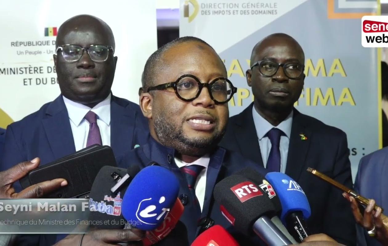
The Inspector of Taxes and State Property, Serigne Moussa Diop, emphasized that digitalization primarily addresses an urgent need: "To restore transparency and trust in a sector plagued by bureaucratic red tape and recurring disputes." He noted that the DGID (General Directorate of Taxes and State Property) is responsible for both tax revenue collection and land governance, two inseparable missions that now require reliable, traceable, and secure procedures. Digitalization thus appears as a way to reduce errors, streamline processes, and facilitate citizens' access to land ownership.
This vision is shared by the Director of the Land Registry, François Ndiaye, who believes that reform cannot be sustainable without a solid technical foundation. He highlighted the investments made in recent years: drones, satellite imagery, digital mapping, and the integration of geographic data. The objective is to better link land rights to the physical reality on the ground, an essential condition for limiting conflicts and improving land-use planning. The Land Registry is destined to become the nerve center of land management, guaranteeing the sustainability of projects once their pilot phase is complete.
Another major development announced is the implementation of an electronic land register. Intended to replace the paper registers used in land registries, this system will be based on electronic data management and a highly secure digital signature. The objective is clear: to accelerate procedures, strengthen traceability, and reduce the risks of fraud or data loss.
The Land Registry Directorate appears as the operational arm of this reform. Equipped with drones, satellite mapping and state-of-the-art digital tools, it will centralize land data and ensure better alignment between land law and the physical reality of the land.
Notaries, land surveyors, academics, and training institutions participated in the discussions, demonstrating the importance of a collaborative approach. Included among the priorities of the government's "New Deal," this digitalization of land management aims to simplify procedures, strengthen equity, and make land a factor of stability and inclusive development.


Commentaires (15)
Je sais comment, sans porter préjudice aux propriétaires.
.
Participer à la Discussion
Règles de la communauté :
💡 Astuce : Utilisez des emojis depuis votre téléphone ou le module emoji ci-dessous. Cliquez sur GIF pour ajouter un GIF animé. Collez un lien X/Twitter, TikTok ou Instagram pour l'afficher automatiquement.